137 Avenue Road Closure
Article by Tony Druett
While the recent closure of 137 Avenue in Edmonton is not directly in BLESS’s area of responsibility, it is something that may have long term impact on the south-east corner of Lois Hole Park.
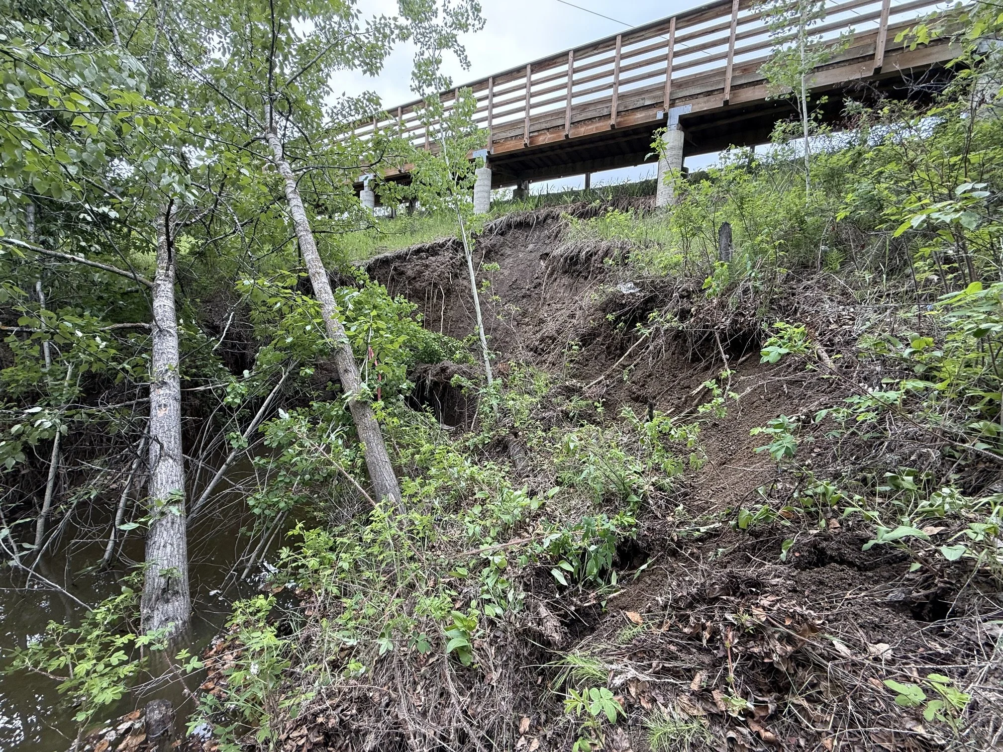
Image: Eroding slope on 137 Avenue. Picture courtesy of Raf Tenderenda.
The instability along the southern property line of 137 Avenue where it crosses over Horseshoe Creek, was first recognised three months ago. Since then, it has escalated and last week the City of Edmonton formally recognised the danger and closed the road. At that location 137 Avenue is situated on a narrow embankment, that was built more than 60 years ago to accommodate what was then just a gravel track within a 66-foot (20 metre) right-of-way. Horseshoe Creek still passes under the road in a rusty, decaying culvert, with a very limited capacity to accept the flow.
Last winter’s heavy snowfalls and the recent heavy rainfall have overloaded this culvert and caused the back-up that has created the erosion now occurring at the southern end of the culvert. That erosion has triggered a major slope failure that has exposed the foundations of the pedestrian bridge. It is now close to causing a further slope failure that could extend right across the road. It is a very dangerous situation.
The City of Edmonton has closed this section of the road indefinitely. They are now putting priority on extending the Starling Drive internal collector road to provide an alternative roadway connection from Ray Gibbon Drive to 199 Street and the Trumpeter neighbourhood. Until that connection is completed there will be no road connection from the east into the rest of the Big Lake Communities. In fact, the only current road access into the Big Lake Communities, including Trumpeter and Hawks Ridge, is from the south on Winterburn Road.
The ultimate solution to this situation will possibly be a new multi-million dollar 137th Avenue bridge over Horseshoe Creek. Construction of that bridge (or a complete rebuilding of the embankment) will almost certainly encroach into the southeast corner of Lois Hole Park. It may also include the installation of an arterial road running north along the eastern boundary of the Park. For that reason, BLESS will be monitoring what is now being planned for this area. We will be lobbying for the impact on the park to be kept to a minimum. If a comprehensive approach is taken, it may eventually result in improved access and trails into the southeast corner of Lois Hole Park.